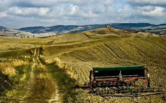
Exploring the Geographic Wonders of the United States offers a glimpse into the nation's stunning landscapes and diverse terrain. From the majestic Grand Canyon and towering Rocky Mountains to the serene Great Lakes and sun-drenched beaches of Hawaii, the United States boasts a wide array of natural wonders. This exploration highlights the beauty and uniqueness of each region, inviting travelers to discover the breathtaking scenery and rich natural heritage that the country has to offer.
The United States of America, a vast and diverse nation, boasts a geographical landscape that is as rich as its history and culture. From the towering mountains and dense forests of the Pacific Northwest to the sun-drenched beaches and urban sprawl of the southern and eastern coasts, the geography of the US offers a breathtaking array of natural and human-made wonders. This exploration delves into the various regions, climate zones, major rivers, landforms, and unique geographical features that define the US.
1. Regional Diversity
The United States can be broadly divided into several distinct regions, each with its own unique geographical characteristics.
The Northeast: This region, including states like New York, Pennsylvania, and Massachusetts, is known for its dense urban areas, historical significance, and rocky coastlines. The Appalachian Mountains run through parts of this region, providing scenic vistas and outdoor recreational opportunities.
The Midwest: Often referred to as the "Breadbasket of the Nation," the Midwest (Ohio, Indiana, Illinois, etc.) is characterized by its fertile plains, which are ideal for agriculture. The Great Lakes, the largest freshwater system in the world, border this region, providing vital water resources and shipping routes.
The South: The southern states (Texas, Georgia, Florida, etc.) are known for their swamps, bayous, and diverse ecosystems. The Gulf Coast offers warm climates and beautiful beaches, while the interior is marked by rolling hills and dense forests.
The West: This vast region, including California, Nevada, and Arizona, is renowned for its deserts, mountains, and stunning national parks. The Pacific Ocean borders the west coast, while the Rocky Mountains and Sierra Nevada provide dramatic landscapes and outdoor adventure opportunities.
2. Climate Zones
The climate of the United States is incredibly diverse, ranging from arid deserts to humid subtropics.
Humid Subtropical: Found in the southern states, this climate is characterized by hot, humid summers and mild winters. Areas like Florida and Louisiana experience high levels of precipitation throughout the year.
Temperate: The majority of the country, including the Midwest and Northeast, falls into this climate zone. It features four distinct seasons with moderate temperatures and significant precipitation, particularly during the spring and fall.

Arid and Semi-Arid: The western states, particularly those in the interior, have arid or semi-arid climates. These regions experience low precipitation and high temperatures, with extreme weather events like droughts and heatwaves being common.
Alpine: The highest elevations of the Rocky Mountains and Sierra Nevada experience alpine climates, with cold, snowy winters and cool, dry summers.
3. Major Rivers
The United States is crisscrossed by numerous rivers, which play crucial roles in transportation, irrigation, and wildlife habitat.
Mississippi River: The longest river in the US, the Mississippi flows from its source in Minnesota to the Gulf of Mexico. It forms a vital part of the country's transportation network and is a key factor in the agricultural productivity of the Midwest.
Missouri River: A major tributary of the Mississippi, the Missouri River rises in Montana and flows through several states before joining the Mississippi in Missouri. It is known for its floodplain agriculture and rich wildlife habitat.
Columbia River: Flowing through Washington, Oregon, and into British Columbia, the Columbia River is the largest in the Pacific Northwest. It is a significant source of hydroelectric power and supports a diverse range of aquatic species.
Rio Grande: This river forms a portion of the border between the US and Mexico, stretching from Colorado to the Gulf of Mexico. It is crucial for irrigation in the arid southwest and is a key habitat for numerous species.

4. Landforms and Topography
The topography of the United States is incredibly varied, ranging from flat plains to towering mountains.
The Great Plains: This vast, flat region stretches from the Mississippi River to the Rocky Mountains. It is characterized by its fertile soil and is ideal for agriculture. The plains are also known for their dramatic weather events, including tornadoes and blizzards.
The Rocky Mountains: This mountain range runs from New Mexico to British Columbia, forming a natural barrier between the plains and the western states. The Rockies are home to numerous national parks and offer incredible opportunities for hiking, skiing, and rock climbing.
The Sierra Nevada: These mountains, located in California, are known for their towering peaks and dramatic landscapes. They are a popular destination for outdoor enthusiasts and are home to Yosemite National Park.
The Appalachian Mountains: While not as tall as the Rockies or Sierra Nevada, the Appalachians still offer scenic vistas and outdoor recreational opportunities. They run from Alabama to Maine and are a key part of the history and culture of the Northeast.
5. Unique Geographical Features
The United States is home to several unique geographical features that are worth exploring.

The Grand Canyon: Located in Arizona, the Grand Canyon is a massive, mile-deep gorge carved by the Colorado River. It is a UNESCO World Heritage Site and a popular tourist destination.
Yellowstone National Park: Known as the "first national park," Yellowstone is located in Wyoming, Idaho, and Montana. It is famous for its geothermal features, including geysers, hot springs, and mud pots.
The Everglades: This vast wetland in Florida is the largest subtropical wilderness in the United States. It is a crucial habitat for numerous species and is a popular destination for eco-tourism.
Niagara Falls: Straddling the border between New York and Ontario, Niagara Falls is a spectacular waterfall that draws millions of visitors each year.
In conclusion, the geography of the United States is a tapestry of diverse regions, climates, rivers, landforms, and unique features. Each of these elements contributes to the rich tapestry of the nation, making it a place of endless discovery and adventure. Whether you're exploring the towering peaks of the Rockies, the fertile plains of the Midwest, or the sun-drenched beaches of the Gulf Coast, the United States offers a geographical experience that is as vast and varied as its people and culture.


